Using LiDAR to Assess Transitions in Riparian Vegetation Structure along a Rural-to-Urban Land Use Gradient in Western North America
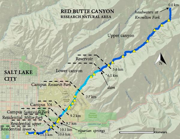
LiDAR and field-based study of riparian forest structure along Red Butte Creek, Utah, finding that land use transitions — especially individual landowner decisions — decouple urban riparian vegetation from stream hydrology, producing exceptionally tall canopies in older residential reaches while native species dominate the protected canyon upstream.
- Region
- Salt Lake City, Utah, USA
- Ecosystem
- Semiarid riparian corridor; montane canyon through urban valley, Great Basin
- Sector
- Academic
- Methods
- Airborne LiDAR (OpenTopography 2013–2014, 8 returns/m²), Point cloud classification and CHM generation (LAStools: lasclassify, lasheight, lascanopy), Spike-free canopy height model (Khosravipour et al. 2016), 50×50 m and 10×50 m plot delineation along smoothed stream centerline (ArcGIS 10.3.1), Height above river (HAR) via Riparian Topography Tools (Dilts 2015), Field woody species surveys: 23 transects, step-point technique (summer 2016), Native status and wetland indicator status classification (USDA PLANTS), GLS mixed-effects regression with spatial covariance structures (R: nlme, gstat, ape, car)